

On June 4th A few friends and I made the 12 hour trek north to Baxter State Park in northern Maine for a much anticipated adventure. This adventure would prove to be a much bigger challenge than I anticipated. This adventure I speak of is our ascent of Mount Katahdin. For those of you who are unaware, Mount Katahdin is Maine’s highest point as well as the northern terminus of the Appalachian Trail. Katahdin was named by the Penobscot Indian tribe and means “The greatest mountain”.

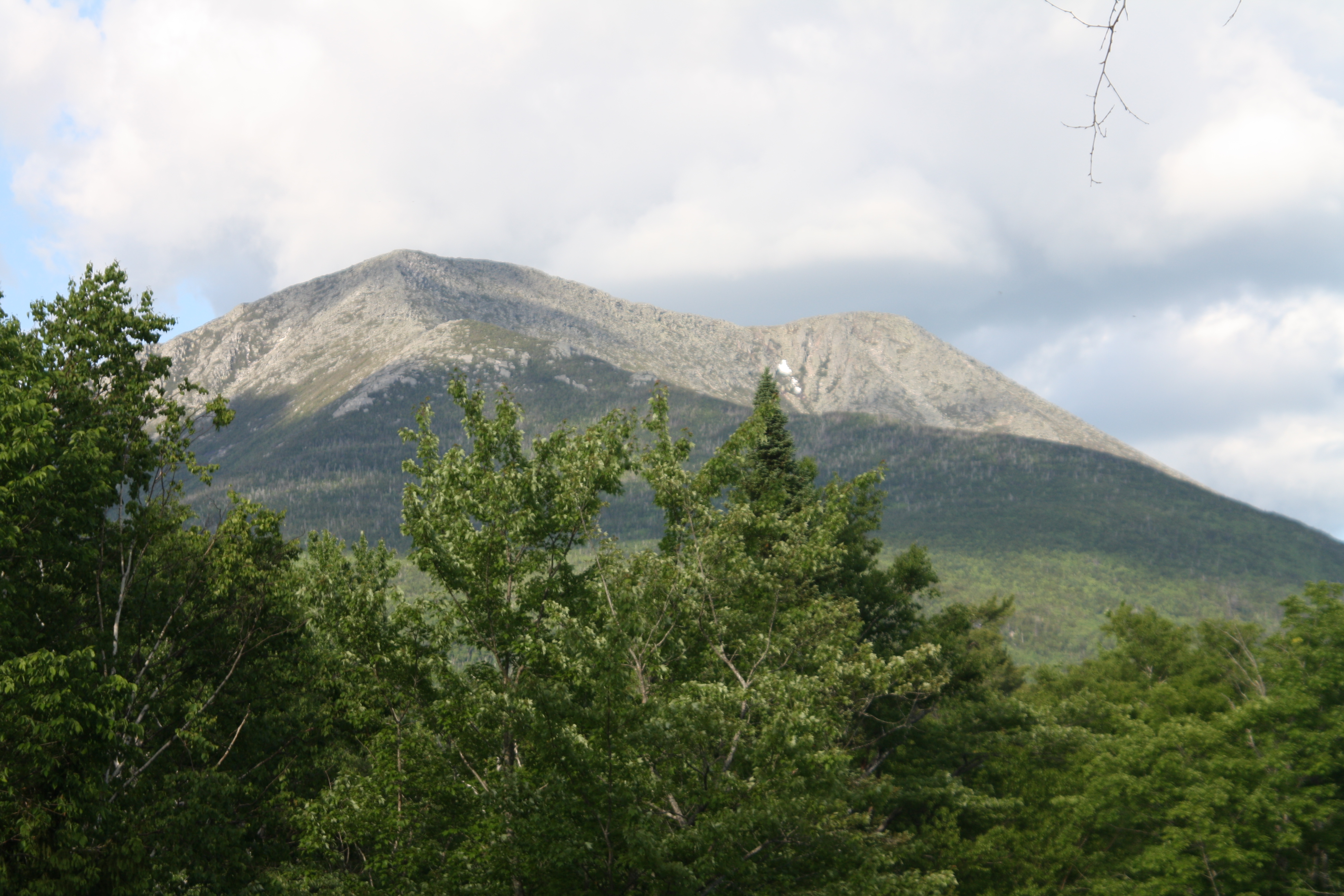
Katahdin may only rise 5,268 from sea level, but keep in mind that several thousand feet of this is above the tree line due to it’s far north location. also all of the area above treeline is littered with granite boulders ranging from fist size to garage size making most of this ascent a strenuous scramble.
We arrived at the Katahdin stream campground at around 715am. This served as the launch pad for our assault on the summit via the Hunt trail. After sorting gear and making sure we had everything we needed we headed up to the trail head and signed in, we were finally summit bound.
We walked for a while on relatively modest terrain that followed Katahdin stream. Then the hike changed abruptly when we arrived at Katahdin stream falls. What started as a mild hike along a forest trail changed suddenly into a scramble across beautiful granite slabs along the quickly rising waterfall. we began to rise into the fog that comes with humidity and rain, this obscured our view through the trees. At about 2 hours in, we finally stepped above the treeline and above the clouds. there was a beautiful view of the Owl to our left.

At this point, the walking ended and the all out scramble on all fours began. For anyone who likes to rock climb, this is where the fun begins. As we made our way up the quickly ascending rock, the tree tops began to drop away, and the clouds started to move out of the area opening up some magnificent views of surrounding Baxter State Park.
For the next mile or so we were greeted by several false summits until we stepped onto a large plateau that had a really unique ecosystem of plants. We followed the white blazes painted on the rocks for quite sometime before coming to Thoreau Spring, which is a mountaintop Natural spring. Shorty beyond here we could see the Sign and Cairn resting on the summit, but it would still be another 45 minutes before we would arrive at the top.
Tired and excited, we reached the Baxter Peak sign around noon. the view to the north was unlike anything I have ever seen. The north face of the mountain dropped nearly straight down thousands of feet, and the small speck of a cabin near chimney pond was barely visible. It was quite an accomplishment in my eyes. We sat down and took a break, but I could not stop staring out to the north. The magnificence of all the open air below me was mesmerizing. To me, this is life!
Elevation Profile Map

Gah! This is awesome! My little brother and I are planning on doing that hike this summer (was supposed to be there all this week but that didn’t pan out.) Any more details you’d like to share? Did you camp? Thanks for posting!
We didnt camp due to not reserving a site in time, but it was definitely a beautiful hike, be sure a reserve parking from the Baxter State park website. get there early, we drove 12 hours straight to get there by 6am this past friday. and bring LOTS of bug spray, but most of all enjoy. this is the most beautiful mountain I have been on.